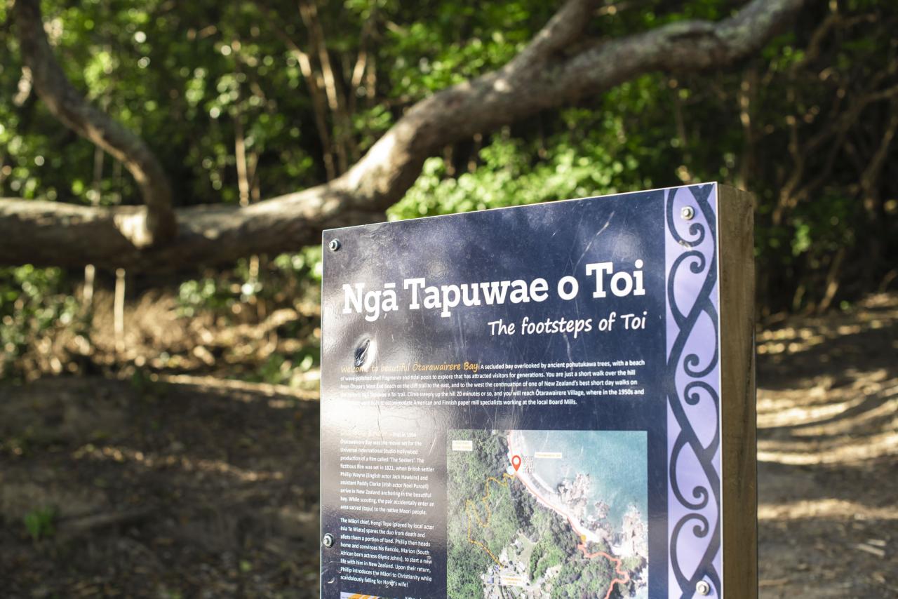
Review of the Ngā Tapuwae o Toi walking track
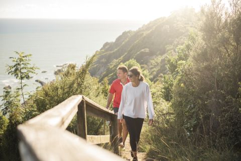
Ngā Tapuwae o Toi doesn't mess around. The first thing you'll see from the entrance off a seldom-trafficked corner of Whakatāne is an imposing set of stairs that goes up... and up... and up. I didn't have a problem with the climb, but if you're not in at least moderately decent shape, this introduction to the "Footsteps of Toi" is going to be a rude awakening for your cardiovascular system.
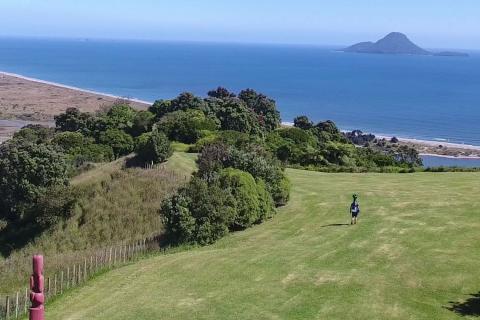
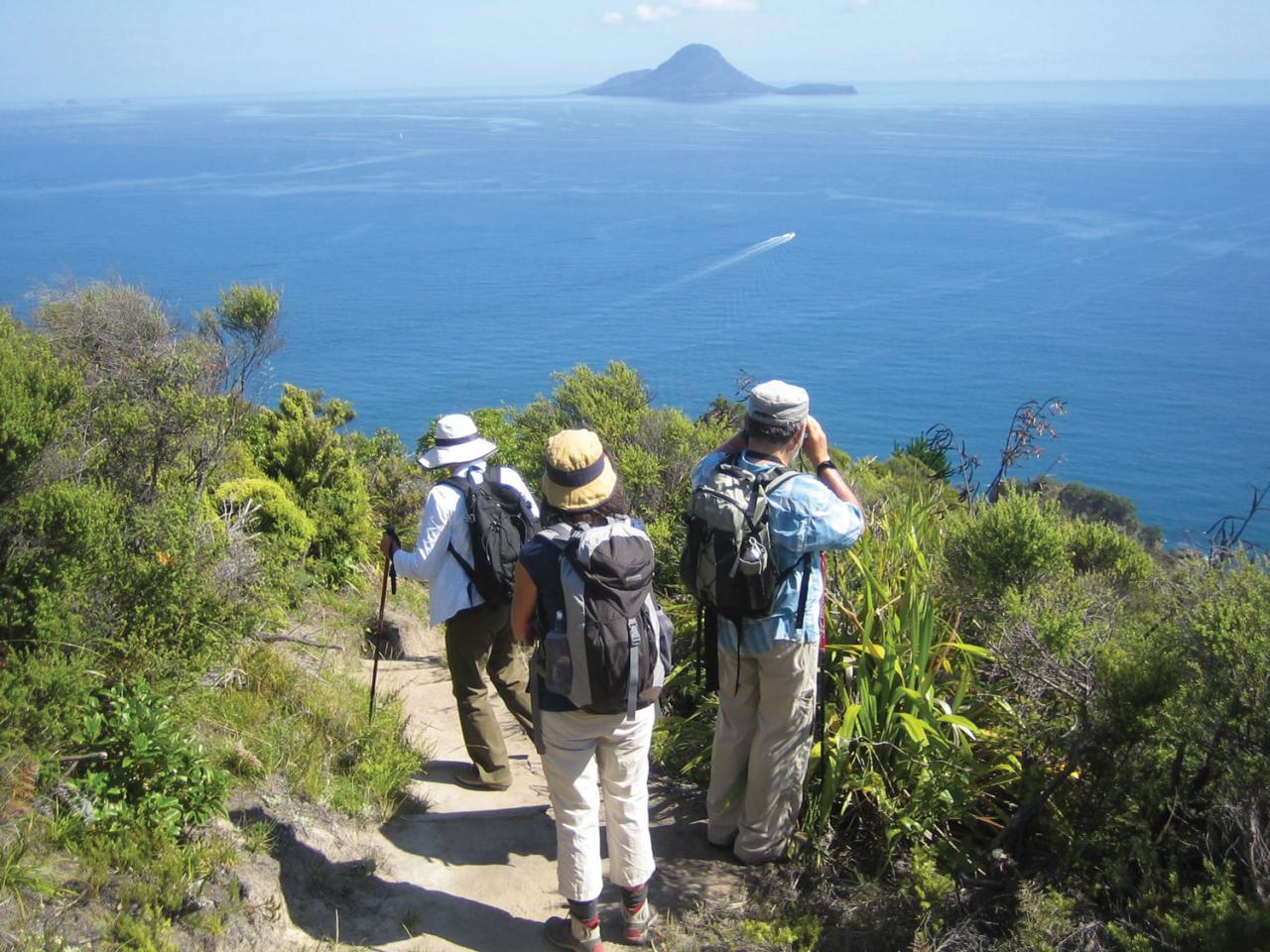
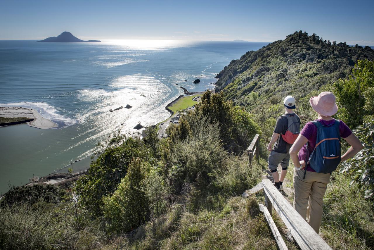
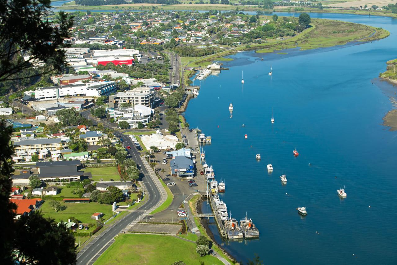
The good news is it's relatively easy going from there onward to Toi's Pa, and again from there to Kohi Point. It's about an hour worth of walking to get to Kohi, but by the time you reach the Point you're rewarded with some of the best views I've seen anywhere in New Zealand. Whakatāne is to the southwest, but from this height and distance it looks less like a city and more like a LEGO village. Whale Island isn't too far off the Point, and you'll have a much better view of it from here than you will from town.
This was roughly when I realised that although I'd brought along my DSLR camera, I'd forgotten its batteries back home. Fortunately I had my iPhone with me, so I was at least able to get some photos while I was out and about. Let that be a lesson to the rest of you: always double-check what you've packed before going on the all-day tramp.
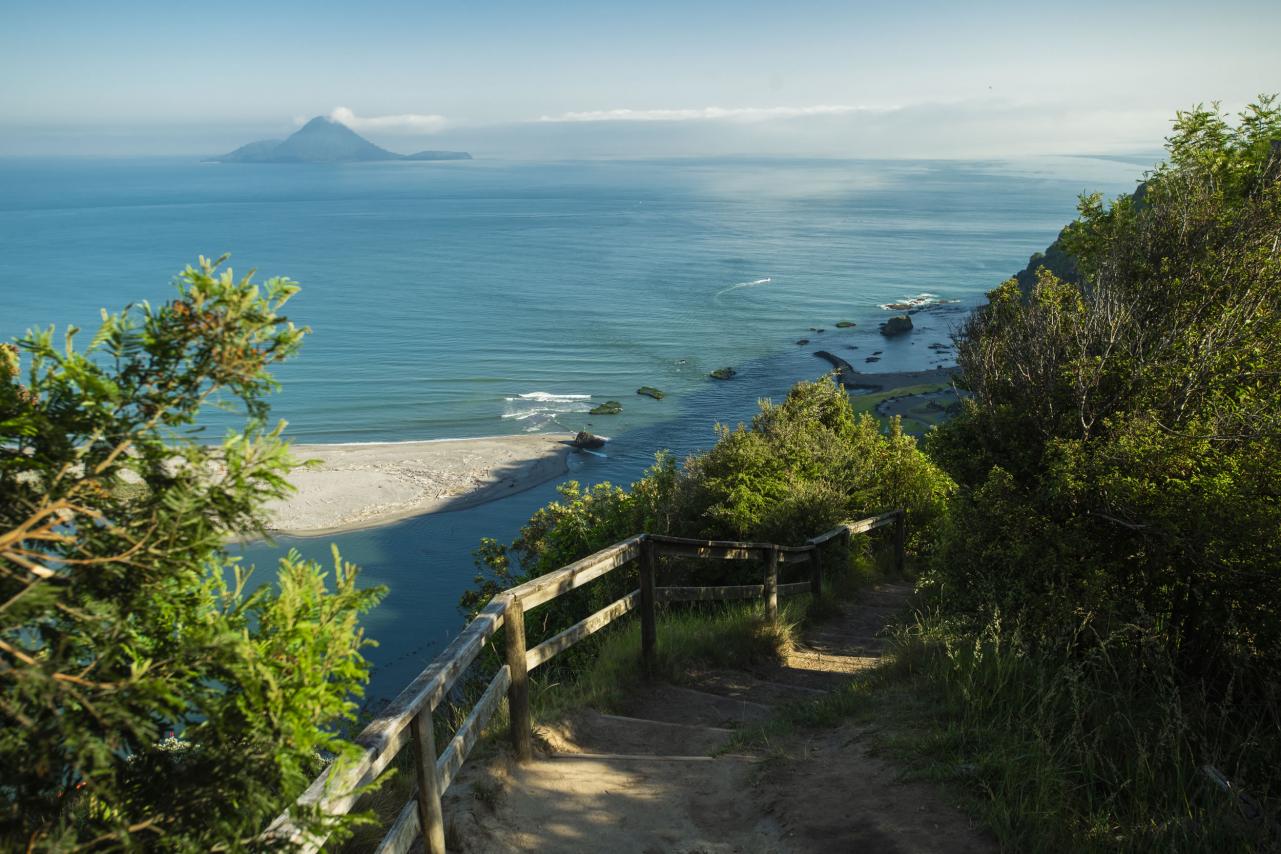
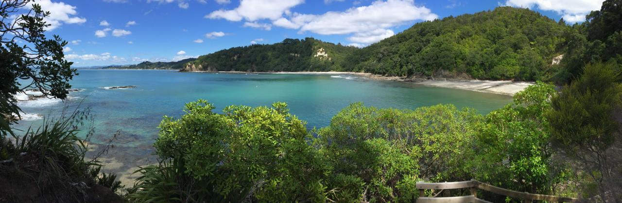
Upon reaching Kohi Point, it's a good time to check the tide tables for the day and see when high tide hits. If high tide is coming within the next couple hours, you may as well turn around and head back the way you came, because Otarawairere Beach won't be accessible. I arrived at the beach just an hour or so after high tide, and even then I had to gingerly make my way around the very edge of the water, negotiating among wet, sharp rocks and piles of washed-up driftwood to make my way to the beach itself.
The somewhat precarious trip was worth it, though. Otarawairere Beach is one of the most peaceful and secluded spots I've been to in what's generally a peaceful and secluded country anyway. I'm sure it's a lot busier (and louder) during peak tourist season, but in late May I had the beach all to myself.
I next walked northeast toward some rather imposing-looking rocks and tried to head around the long way toward Ōhope. However, eventually I came to a flooded area where the ocean drained into a cave of some sort, and I had to loop back around to the beach to take the more conventional route onward.
Another steep climb up the hill and a set of stairs back down takes you to West End in Ōhope Beach. Now you have a choice to make: take a bus back to Whakatāne, or do what I did and complete the entire loop. Your choice is going to depend on a lot of factors, like your fitness level, whether you have any kids with you, what time of day it is, and so forth. For me, the choice was easy; after stopping for "fush and chups" at the Quay Cafe, I headed for the Ōhope Scenic Reserve, the start of the loop back toward Whakatāne.
The second half of the trip was more physically challenging than the first half, with many steep sections that left me winded and pausing to catch my breath. The scenery was nice enough, but it didn't have nearly the "wow" factor that Kohi Point and Otarawairere Beach had.
Midway back to Whakatāne, the track runs over private property. In some spots the track isn't labelled very clearly, so it could be easy to get lost (like I did) and end up wandering a couple kilometres off course onto some farmer's land. Google Maps on my iPhone saved me from straying too far off course, thankfully.
The last part of the walk is, weirdly, right on the outskirts of Whakatāne along Commerce Street, eventually intersecting with the CBD. I hit the Craic Bar for a well-deserved Guinness, rested my weary feet for half an hour or so sitting in a chair on The Strand, and finally got back in my car and headed home to Ōhope.
Department of Conservation's description of the walking track generally defines it as an easy or moderate walk. This is true compared to other walks in New Zealand -- the Footsteps of Toi isn't nearly as challenging as, say, climbing Mount Ngauruhoe on the Tongariro Northern Circuit -- but if you're a dedicated couch potato or otherwise physically challenged you'll find portions of this walk to be fairly demanding.
"I hit the Craic Bar for a well-deserved Guinness, rested my weary feet for half an hour or so sitting in a chair on The Strand, and finally got back in my car and headed home..."
My first round-trip on the walking track, back in May, took around seven hours. This was mostly because I was pausing for pictures and taking various detours to explore. I've since brought my time down to three hours and 40 minutes for the entire 18 kilometre track.
I've also done the track in reverse order, going counterclockwise and starting at the Whakatāne side of Ōhope Road. While the progression of scenery going in this direction is much more exciting, it's also far more challenging; tramping the track clockwise means all the steepest sections are on a downhill slope, so naturally coming at it from the other direction means some quite challenging climbs.
Overall, the Ngā Tapuwae o Toi walking track is definitely an experience worth the time and effort. In the months since the first time I walked the track, the weather has improved considerably, and I've made this walk a weekly part of my exercise regimen.
Chris Rawson moved to New Zealand from the United States in mid-2008. After close to five years in Palmerston North, he moved to Ōhope Beach in 2013. He definitely considers this a good trade.